
Reading the History of Your Land
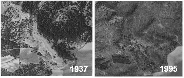
Air photos have been taken periodically of Wisconsin, starting in the late 1930s and continuing through today. You may be able to pull together a series of photos for your property that will give you insight into the history of your land.
You might be surprised by what you find. In many cases, for example, south- and west-facing hillsides had many fewer trees than today. They were part of the pre-settlement prairies and oak savannas that have now “darkened” on aerial images into woods.
You may also be able to distinguish evergreen trees in the photos; on south and west slopes these would likely be Eastern red cedars, which have also grown in over areas that once were prairie.
Historical air photos may be available for your property through your local Farm Services Agency office, Natural Resources Conservation Service office, the Robinson Map Library at the University of Wisconsin–Madison, or the Wisconsin State Cartographer’s Office.