
Snapshot Wisconsin: A Digital Glimpse into Your Woods
Want to see more of what's in your woods while helping the state of Wisconsin? Learn more about the Snapshot WI program!
By Denise Thornton
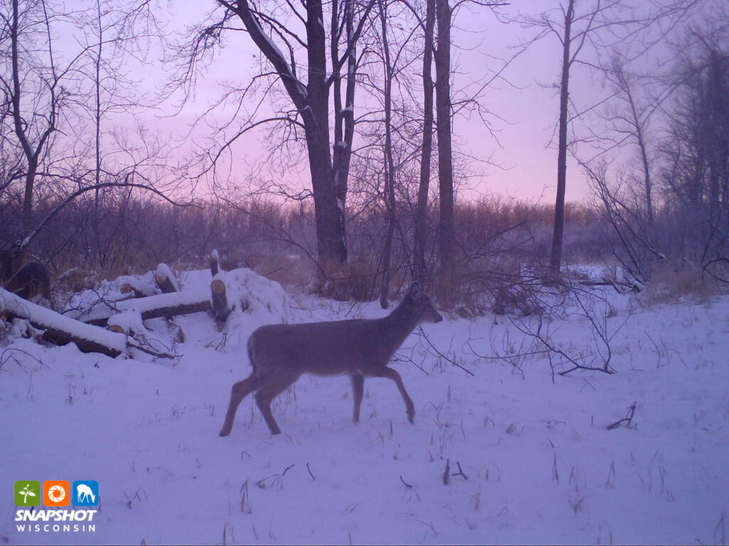
Snapshot Wisconsin, a volunteer-based Wisconsin DNR trail cam project, helps landowners catch a glimpse of the varied wildlife that share their land. “It’s my eye in the woods,” says volunteer Mary Stenberg. The project also provides the DNR with data that aids in making informed management decisions.
The program began in 2015 at the same time that Wisconsin was initiating a second reintroduction effort of elk. “We wanted to monitor all species, but this was a good opportunity to help monitor the elk,” says Snapshot Wisconsin Operations Manager, Mackenzie Glasford. “We started small. By 2018 we had opened to all 72 counties. This year, we reached over 100 million photos in our system.” The best photos are available to the public through an online photo library. Wisconsin has the country’s largest trail cam project that Glasford is aware of.
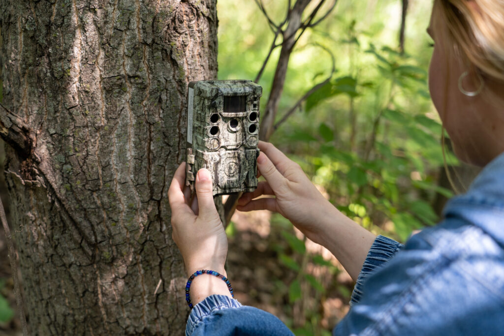
Applicants to the project receive all necessary equipment and training. “Our research scientists evaluated which settings would work best for our project. The cameras selected are set up to take three photos each time the camera is activated by motion,” says Glasford.
Applicants must have:
- access to at least 10 contiguous acres of public or private property.
- basic computer skills.
- access to high-speed internet.
- access to a Windows or Mac computer that can access the Snapshot program.
- the ability to check the camera at least once every 90 days for at least one year.
Wisconsin has been divided into over 6,000 survey blocks. For those interested in becoming a Snapshot Wisconsin volunteer, check the trail camera hosting application, and tap the “close” tab at the bottom of the link to see the map of survey blocks. Enter your address to learn if a survey block on your property is currently available. If it is already filled, you can ask to be on a waiting list. It is also possible to host a camera on public land, with permission from the land manager.
Volunteer Elizabeth Usborne found a survey block was available on her land near Menomonie and joined the program about three years ago. “It’s a beautiful area with rolling hills, creeks, and forest. My property is on top of one of the hills,” she says. “The hilltops were once farmed, so the top was a brome grass hay field. I did a three-acre monarch habitat that now includes 30 good pollinator plants.”
“The previous landowner grazed sheep on the slopes that they couldn’t farm, an logged the harvestable timber. What grew back were these wolf oaks — big, gnarly trees not salvageable for lumber, but they are great habitat for bats. Part of my management has been thinning out the oak canopy and starting to cultivate a diverse-aged forest. There is a huge patch of wild ginger, and we’ve got ramps, morels, berries, and deer and turkeys,” Usborne says. “It’s a fun place to be in, and the trail camera is part of that fun.”
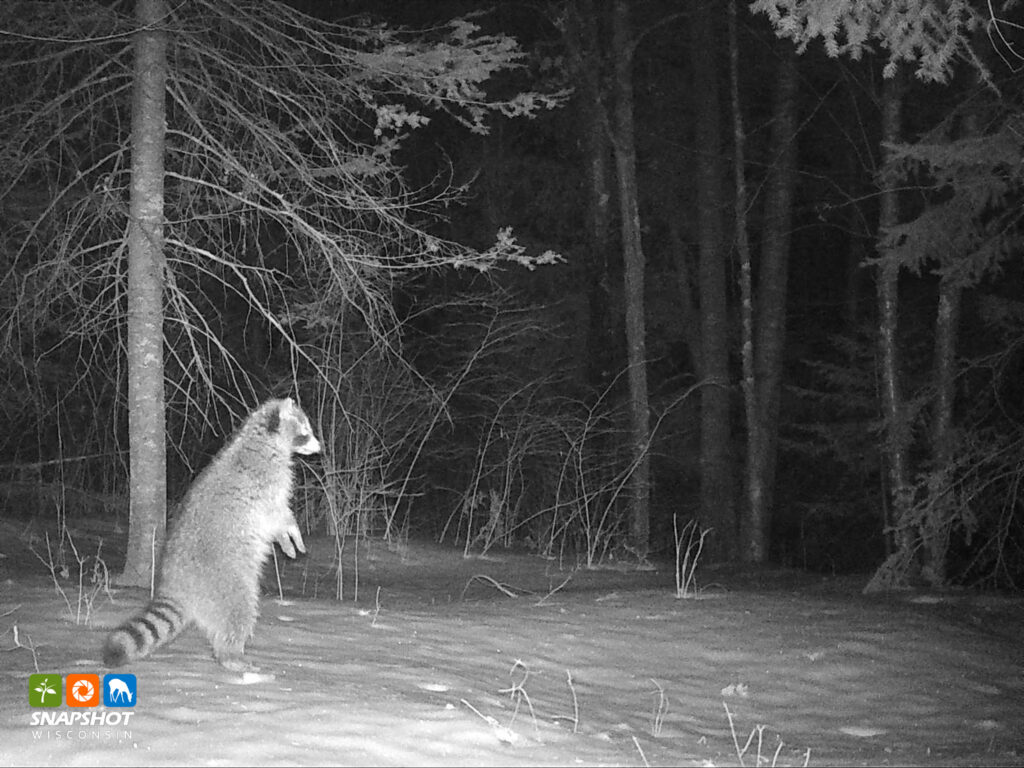
Usborne has done some prescribed burns to maintain the monarch meadow. “It’s neat to see how animals use the space, and how popular it is after a burn. Everything from songbirds getting the bugs that are easier to find, raccoons, coyotes, and rabbits. It’s easier to see them when they are not hidden by the tall grass. We’ve snapped a black bear with three cubs, and a flying squirrel. Also, lots of deer, a ton of turkeys, coyotes, and bobcats.”
“Every now and then a raccoon knocks the camera down so that it’s pointing at the ground,” she says. “Then I get a window into the life of all these mice and little ground critters when they are out on errands, and not feeling observed.”
Usborne says Snapshot Wisconsin maintains a great relationship with its volunteers. “Changing batteries and the memory card is pretty easy. Then you can go through those pictures. It’s fun, easy, and engaging. They are also great about connecting volunteers with how the information is being used and the recognition the program is getting (thanks to their volunteers) through their newsletter, emails, and volunteer events. You get great information about your own land, and it connects you to the big picture of how this is all fitting together,” says Usborne.
To learn what information Snapshot Wisconsin has compiled, check its Data Dashboard. At this link, you can check out how different species are dispersed in our state, county by county. You can also learn about what time of day and time of year each of these species are active.
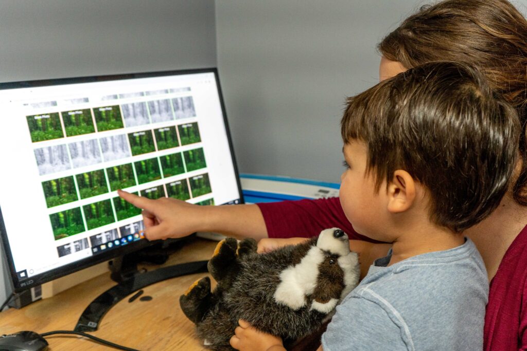
Volunteers get the first opportunity to see and classify the photos. “Volunteers are not required to ID their photos,” Glasford says, “but a lot of people categorize the photos with their family, and many use the activity as a way to connect their children with their land.”
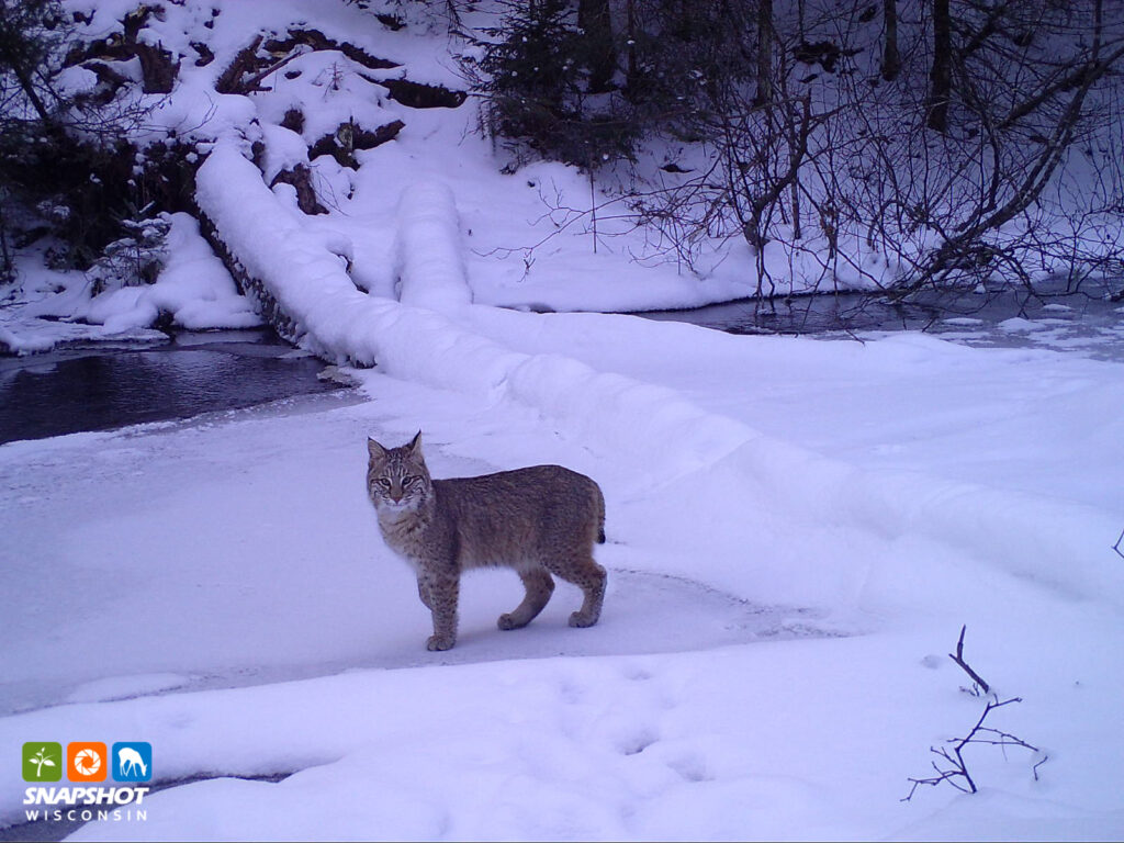
Occasionally Snapshot photos can reveal unexpected results, as they did for Snapshot volunteer Mary Stenberg. “We had a flock of chickens that we kept in a pen of nylon netting during the days,” she remembers. “One evening I had a Zoom call committee meeting, so I couldn’t put the chickens in at dusk. When I went out after the meeting, there was a hole in the netting, a dead chicken in the pen, and one chicken was missing. It was March 9, and there was no snow to check for tracks. When we collected the photo card April 1, there was a bobcat walking along and carrying our chicken in its mouth! “
Stenberg and her husband have 120 acres near Ashland in Bayfield County. They installed a Snapshot Wisconsin trail camera in 2020 about a quarter mile east of their house. “We live in the woods, and put the camera in a spot along a creek,” she says. “It is amazing to me what is in the woods so close to our house.” We check our camera every 30 days. I’m always curious to see what we have captured.”
Stenberg is pleased that Snapshot Wisconsin uses the images for public information programs and educational programs for schools. “I’ve been to Snapshot Wisconsin programs at Hunt Hill Nature Center. Participants go out and check cameras as part of school field trips.
Snapshot Wisconsin can offer schools a hands-on method to teach science. Classes can host a trail camera in a school forest or on nearby public land. Teachers who don’t have access to a trail cam can also have their classes to identify photos of Wisconsin wildlife at Snapshot Wisconsin’s Zooniverse crowdsourcing site.
“This opportunity is open to everyone. You can consider joining thousands of other volunteers on Zooniverse, where people from across the globe help classify the wildlife captured in the photos,” says Glasford. Zooniverse is a world-wide platform helping enable research that would not be possible or practical otherwise.
As for Stenberg, she says, “I head out to my camera on the 15th of each month. There is always something new to see.The deer are curious. Even though the camera has been mounted to the same tree for five years, they still walk up to it. There is a tree leaning near the camera, and last month some turkeys decided to roost on it. I grew up with nature and this camera a great nature source.” Even the most common animal images can provide joy, along with valuable data to the future of wildlife management.